Project ATLAS Support
McCormick Taylor provides project management, business analysis, and GIS analysis support for NCDOT’s Project ATLAS (Advancing Transportation through Linkages, Automation, and Screening).
The Challenge
The overarching goal for Project ATLAS is to support a more efficient project delivery process within the agency by leveraging GIS to identify project risks earlier and by supporting data governance for project documentation.
How We Helped
At NCDOT’s direction, McCormick Taylor is building two ArcGIS Experience Builder applications to support business workflows within the Department. In the first instance, McCormick Taylor is working with the NCDOT Hydraulics Group to develop the Hydraulic Risk Assessment Tool that will allow the group to identify projects that need a more in-depth hydraulic analysis based on a number of factors including project profile, proximity to dams and ponds and the presence of wide floodplains and existing development within the project footprint. The second application has been developed in response to the damage wrought by Hurricane Helene in Western North Carolina. NCDOT asked for help developing a model for prioritizing repairs. The current iteration integrates functional classification, AADT, snowplow routes, and the results of a community isolation analysis into its scoring matrix. The Experience Builder application allows users to review field notes and images taken post-storm, filter the results by specific scoring factors, and add their own notes regarding prioritization.
- Data Cleanup and Automation: NCDOT’s Right-of-Way Unit launched an initiative that pulled CAD design files for ten years of State Transportation Improvement Projects (TIP) into more than 20 GIS layers. Some of the layers contained over 100,000 features, many of which were redundant. In addition, point features such as meters and valves were captured as multiple line features that represented the shape of each feature. These issues made the layers slow to load and reduced their value to end users. McCormick Taylor worked on Python scripts to remove redundant features, convert structures to point features, incorporate let dates from another table, and integrate annotation information as a field in the appropriate feature layer. After the data was cleaned up, the layers were added to the ATLAS mapping tools for use in planning efforts.
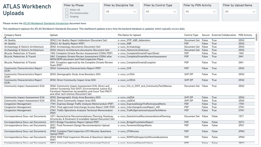
- End User Engagement and Application Testing: McCormick Taylor has developed and led trainings, met with NCDOT technical units about their GIS and data governance needs, and tracked usage of the ATLAS tools through database analysis. Currently NCDOT is overhauling its existing ATLAS Search and Screening map-based tools with “ATLAS Map,” a more integrated, cloud-based application.
Results
Project ATLAS is part of a larger department-wide effort to streamline the project-delivery process. McCormick Taylor works closely with NCDOT to create new data layers, tools, and applications that help
staff better leverage GIS in their day-to-day workflows and decision making. The data we are creating as part of the Hydraulic Risk Assessment Tool and the ROWMS data cleanup will both result in layers that are fed back into the ATLAS tools. Additionally, our efforts on tool usability have identified opportunities for application improvements and provided have led to productive conversations with end users in terms of the pain points in terms of how they use the ATLAS tools.