Planning
Shaping the Future with Thoughtful Planning and Multimodal Design
Video at the head of the service page.
Transcript of video content:
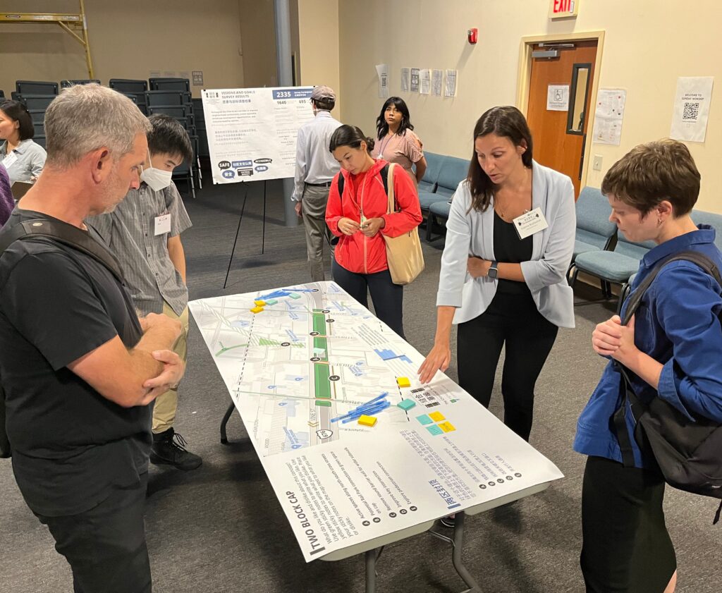
Closeup of people viewing an intersection design print on a table top.
A booklet flutters in from the left side of the screen before flipping around and closing to reveal the cover with the title “New Castle County Comprehensive Plan 2050.” A second booklet entitled “Sustainability Playbook” appears from behind the first book.
Bikers ride on a bike trail through a grassy landscape with trees and a fence on a sunny day. A “ pedestrians only” sign is in the foreground on the left side of the screen
A subway running along a station platform with superimposed advertisements for TalkPATransportation.com and PennDOT
A public meeting with a project manager explaining roadway designs displayed on an easel to a citizen with several other citizens viewing additional prints on tables.
A couple walking a dog on a bike and pedestrian path with trees, with bikers and a blue sky in the background
A citizen applying labels to a SEPTA Trolley Modernization display board at a public workshop
Bikers ride along a bike path flanked by wooden fences, a grassy landscape, trees and a blue sky with clouds in the background.
A New Jersey Transit light rail vehicle approaches the viewer through a small town street.
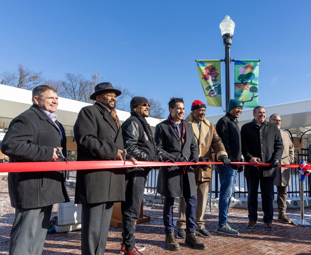
A man addresses a group of people at an outdoor public meeting in front of displays on a park fence
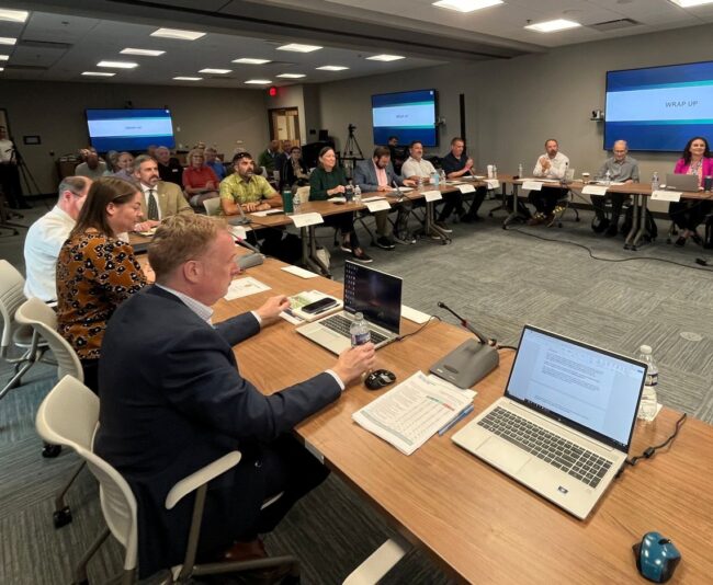
A speaker listens to a person at a public meeting with numerous attendees seated at tables.
End of video transcript.
McCormick Taylor’s engineers and planners understand that modern transportation systems require a holistic approach that integrates multiple modes to create efficient, accessible, and sustainable mobility solutions. It shapes how we feel about where we live, work, and play, influencing the quality, accessibility, and sustainability of our communities. Thoughtful transportation and community planning ensures that people and places are connected in ways that promote safety, equity, and economic vitality.
Our team of planners and communications specialists work closely with clients and stakeholders to develop integrated, forward-thinking solutions that balance mobility needs with land use, environmental considerations, and community goals. From comprehensive transportation studies and corridor planning to public engagement and policy development, we help design vibrant, accessible communities that support healthier lifestyles and stronger connections.
Service Capabilities
- Community Visioning
- Corridor Plans
- Parks & Open Space Plans
- Small Area Plans
- Socioeconomic Plans
- Strategic Plans
- Vision Zero Plans
- County/Municipal Plans
- Land Use Plans
- Master Plans
- Scenario Planning
- ADA Compliance
- Bicycle and Pedestrian Facilities
- Bicycle Storage
- Complete Streets
- Network Planning
- Neighborhood Slow Zones
- Rails-To-Trails
- Recreational Trails & Parks
- Safe Routes to School
- Shared Mobility
- Shared Use Paths
- Shared Mobility
- Traffic Calming Facilities
- Trails & Greenways
- Vision Zero Planning
- Wayfinding & Historical Signage
- First/Last Mile Access
- Origin-Destination Surveys
- Route Planning
- Operations & Service Planning
- Station Design
- Transit-Oriented Development (TOD) Planning
- Shared Mobility
- Bicycle Level of Traffic Stress
- Crash Analysis
- Data Dashboards
- Data Management
- Demand / Propensity Analyses
- Equity Analysis
- Gap Analysis
- Multimodal Level of Service
- Pedestrian Level of Comfort
- Story Maps
- Traffic Forecasting
- Travel Demand Management
- Funding Identification
- Grant Management
- Grant Writing/Applications
- Long-range Transportation Planning
- Greenways Planning
- Heritage Planning
- NEPA Compliance Process & Documentation
- Planning & Environmental Linkages (PEL) Implementation
- Watershed Planning & Assessments
- Data Analysis & Management
- Federal, State, & Local Officials Coordination
- Graphic Design & Creative Services
- Media Coordination
- Policy & Program Development & Delivery
- Public & Stakeholder Engagement
- Strategic Communications
- Application Development
- Data Management
- GIS Spatial Analysis, Mapping, & Modeling
- Virtual Public Involvement
- Website Development
- 3D Renderings & Animation
- Branding & Identity
- Content Marketing & Strategy
- Graphic Design & Illustration
- Video Production & Photography
Community Planning
- Community Visioning
- Corridor Plans
- Parks & Open Space Plans
- Small Area Plans
- Socioeconomic Plans
- Strategic Plans
- Vision Zero Plans
Comprehensive Planning
- County/Municipal Plans
- Land Use Plans
- Master Plans
- Scenario Planning
Multimodal Planning & Design
- ADA Compliance
- Bicycle and Pedestrian Facilities
- Bicycle Storage
- Complete Streets
- Network Planning
- Neighborhood Slow Zones
- Rails-To-Trails
- Recreational Trails & Parks
- Safe Routes to School
- Shared Mobility
- Shared Use Paths
- Shared Mobility
- Traffic Calming Facilities
- Trails & Greenways
- Vision Zero Planning
- Wayfinding & Historical Signage
Transit Planning & Design
- First/Last Mile Access
- Origin-Destination Surveys
- Route Planning
- Operations & Service Planning
- Station Design
- Transit-Oriented Development (TOD) Planning
- Shared Mobility
Data Analysis & Visualization
- Bicycle Level of Traffic Stress
- Crash Analysis
- Data Dashboards
- Data Management
- Demand / Propensity Analyses
- Equity Analysis
- Gap Analysis
- Multimodal Level of Service
- Pedestrian Level of Comfort
- Story Maps
- Traffic Forecasting
- Travel Demand Management
Program Planning & Grants
- Funding Identification
- Grant Management
- Grant Writing/Applications
- Long-range Transportation Planning
Environmental Planning
- Greenways Planning
- Heritage Planning
- NEPA Compliance Process & Documentation
- Planning & Environmental Linkages (PEL) Implementation
- Watershed Planning & Assessments
Communications & Engagement
- Data Analysis & Management
- Federal, State, & Local Officials Coordination
- Graphic Design & Creative Services
- Media Coordination
- Policy & Program Development & Delivery
- Public & Stakeholder Engagement
- Strategic Communications
GIS & Technology
- Application Development
- Data Management
- GIS Spatial Analysis, Mapping, & Modeling
- Virtual Public Involvement
- Website Development
Creative Services
- 3D Renderings & Animation
- Branding & Identity
- Content Marketing & Strategy
- Graphic Design & Illustration
- Video Production & Photography
Projects
view all-
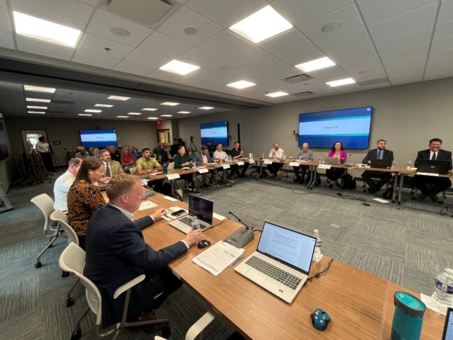
Land Use Reform Working Group
Delaware -
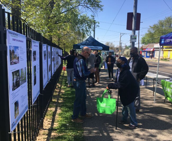
Blossom At Bartram! Complete Streets Public Engagement
Philadelphia, PA -
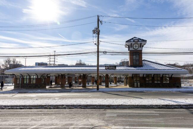
Wissahickon Transit Center Improvements
Philadelphia, PA -
Lancaster Station Small Area Plan
Lancaster County, PA -
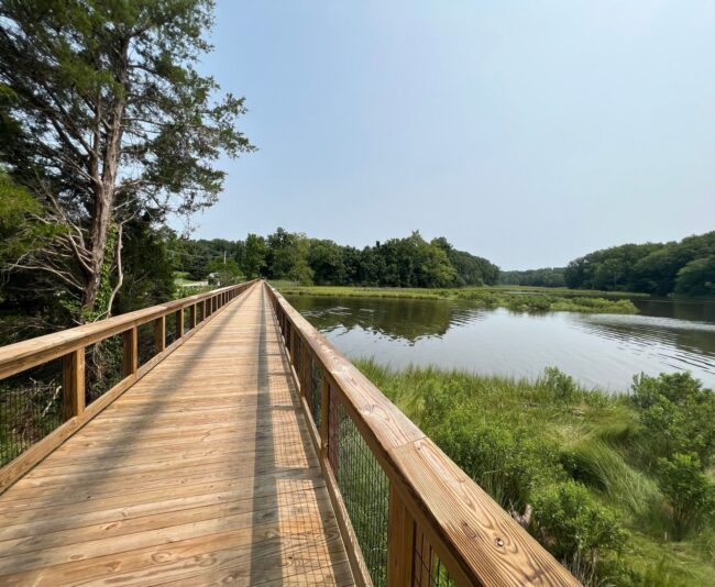
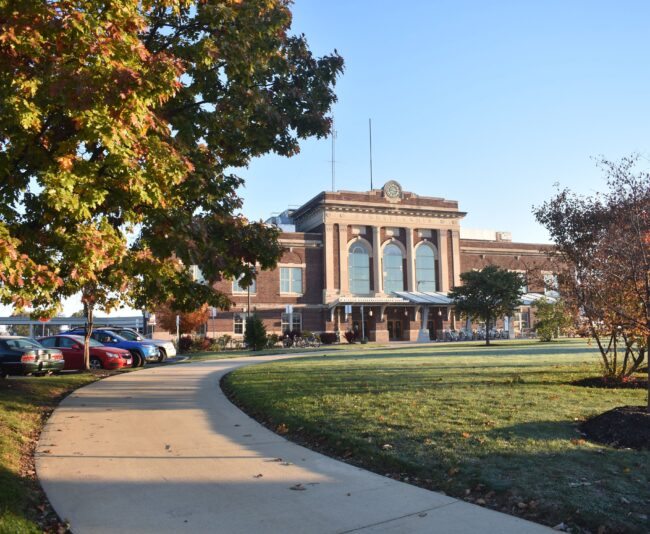
St. Mary’s College of Maryland Recreational Trail
St. Mary's City, MD -
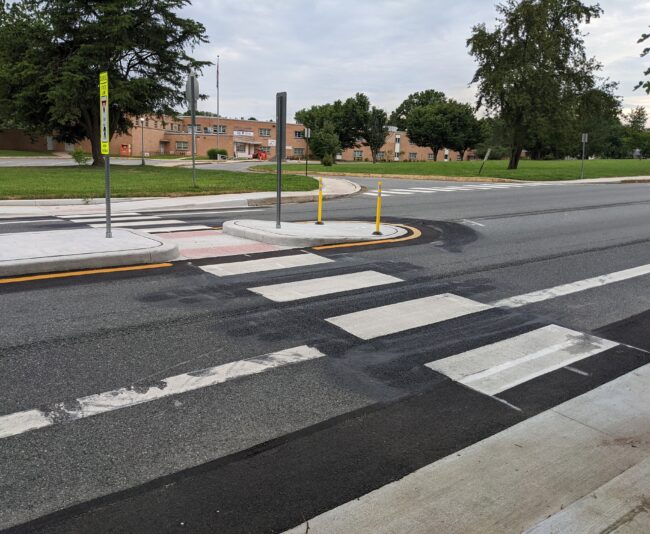
Safe Routes to School – Downes Elementary
Newark, DE

Contact Us
Connect with a service leader to learn about our solutions for your project or partnering needs.
Our People Move Us